Eston Nab – Iron Age Hill-fort and Napoleonic Beacon

Geotag Icon Show on map

The remain of earthworks surrounding the Iron Age Fort are still very prominent on the ground.

Eston_Nab_-_Iron_Age_hillfort

Tees Archaeology have produced an excellent leaflet on the subject here.
Eston Nab Ironage Hill Fort Eston Nab Ironage Hill Fort

The Napoleonic Beacon was built in 1808 as part of a chain to warn of attack.

The actual watchtower appears to have been built and little later around 1819/1820 (thanks to Joan for the additional information), that later became a private residence and was inhabited up until the 1950s.

phplJGkyn

It was demolised in 1956 and ICI erected the current monument.
Eston Nab Eston Nab Eston Nab

The view from the top is still spectacular

Eston Nab

Ayton Banks Ironstone Mine

Geotag Icon Show on map

Ayton Banks was mined by three different companies between 1909 and 1929, it was a small royalty entirely enclosed within Ayton Monument mine.
The most obvious remains are the numerous shale heaps, some with ironwork on top probably from aerial ropeways.

Ayton Banks Ironstone Mine

A number of building remains and foundation can be spotted in the dense undergrowth

Ayton Banks Ironstone Mine Ayton Banks Ironstone Mine  Ayton Banks Ironstone Mine

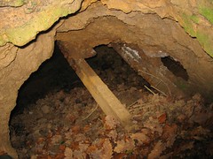
A very small length of drift is visible at the bottom of a large collapse, but its tricky to reach and also flooded.

Ayton Banks Ironstone Mine

About 100m to the south of the drift, iron stained water can be seen emerging from what was presumably a drainage level, this appears to be lined with corrugated iron sheets which have collapsed a few feet in, water can again be seen at the bottom of that collapse.

Ayton Banks Ironstone Mine  Ayton Banks Ironstone Mine

Victorian Urinal and bridge dedicated to Ironstone Miners

Geotag Icon Show on map

The bridge into Waterfall Park in Great Ayton is dedicated to five ironstone miners who lost their lives in the First World War.
Great Ayton Bridge
The under manager George Whitbread worked at Ayton Monument rather than Ayton Banks.

Over the bridge is a cast iron Victorian Urinal, it was originally one of three, it moved here in 1998 from Station Road.
Great Ayton Urinal

Castleton ROC Post

Geotag Icon Show on map

 I first visited this ROC post about six years ago, at the time it was in good condition, dry with numerous papers still on the wall. Unfortunately I’ve been unable to locate the photos I took that day with my first brick sized digital camera, you can however get an idea of how it used to look here.

Two lonely telegraph poles which once carried the communications point out the site from the road.

Castleton ROC Post 

The surface features are pretty much unchanged, although the lid has been removed and thrown into the shaft.

Castleton ROC Post Castleton ROC Post Castleton ROC Post

Being open to the elements means theres now an inch of water at the bottom of the ladder, all the paper and card items once inside are either gone or soaked, the cupboards have also been smashed up.

Castleton ROC Post Castleton ROC Post Castleton ROC Post 

The switch mechanism which was on the wall near the door in the older photos seems to have been very carefully removed, hopefully this has been taken to a museum or by someone restoring another ROC post rather than as a personal trophy.

ROC posts are fast disappearing or being vandalised, the fantastic example at Hinderwell was filled with soil in the last couple of years. No idea if any of the fixtures or fittings were saved before this was done.

CANTAT-3 and Pangea North Landing Point

Geotag Icon Show on map

Two large telecommunications cables land on the Stray between Redcar and Marske.

CANTAT-3 links to Canada, Iceland, Faroe Islands, Denark and Germany.

Pangea North links to Fanø in Denmark
On Google Earth they can be clearly seen to line up with two rows of large posts either side of the car park, which must have been placed to alert any rogue JCBs to their position.

cables.jpg

Skinningrove 1848 Ironstone Drifts

Very close to the Cleveland Ironstone Mining Museum which is well worth a visit to see the later North Drift, are the remains of the original 1848 drift in Skinningrove.

Skinningrove Ironstone Drifts Skinningrove Ironstone Drifts

I have no idea what purpose the cupboard like structure currently inside served, it appears to be from after the tunnel was blocked.
The adjacent small tunnel looks likely to have been for drainage.
Skinningrove Ironstone Drifts

This was the first of the Cleveland ironstone mines and finally closed in 1958-1959.

CATS Gas Pipeline Landing Point

Geotag Icon Show on map

This unmarked (but highly secured) little building is the landing point for the CATS gas pipeline
CANTAT-3 Landing Point CANTAT-3 Landing Point

The CATS (Central Area Transmission System) pipeline is a 36-inch diameter pipe transporting gas from fields in the central North Sea to terminals at Teesside.Clicking the ‘Show On Map’ button above clearly shows the line of a trench running NE towards the sea.