Northallerton Purple Beech Trees

Geotag Icon Show on map

May 12th 1937 These Purple Beech Trees were planted in commemoration of the coronation of His Majesty King George VI.
Northallerton Purple Beech
The trees were planted in the order named (South to North) by members of the Northallerton Urban District Council

T. Woodhead J.P.C.C.
A. E. Skelton
C. Fowler
G. J. Cotton
W. Barker
G. East
J. Avey
J. Kellett
A. Howard (Chairman)
R. Hill
W. Watson
R. Norris

I. W. Atlay J.P. (ex-councillor)
E. O. Hillyard Surveyor
H. G. Hanan Medical Officer of Health
Zion Women’s Guild of Service
Northallerton Purple Beech

They can all still clearly be seen from the Google Maps view.

Witch Post – Hutton-Le-Hole

Geotag Icon Show on map

Witch Posts are nearly exclusively found in the North Yorks Moors with example being found at Glaisdale, Danby, Rosedale, Gillamoor, Farndale, Egton, Goathland, Lealholm and Silpho. The example at the Ryedale Folk Museum is originally from Stang End at Danby
Witch Post - Hutton Le Hole
They are said to prevent witches from flying down the chimney by placing a St Andrew’s cross on one of the fireplace posts.

witch posts

This drawing of other examples don’t always look like a St Andrew’s cross to me and the true meaning of the symbols and history of the tradition seem to have been lost.


Bee Houses / Bee Boles, Hutton-le-Hole

Geotag Icon Show on map

A bee boles (or Bee House as they are know locally) is a recess in a wall where a straw ‘skep’ would have been sheltered from the wind and rain before the development of modern bee-hives (rougly pre-1850)
Bee Boles - Hutton Le Hole
This reconstruction is at the Folk Museum in Hutton-le-Hole, although there are actual examples still in Glaisdale and Westerdale.

Verjuice Press / Beam Press – Farndale

Geotag Icon Show on map

This verjuice press lies partially covered by a tree in Farndale. Verjuice is the acidic juice of crab apples, traditionally used in cooking and medicine. A large stone would have been placed on top and a beam used to make it squeeze the fruit, with the juice running out of the carved channels.
Verjuice Press, Farndale
This photograph of an olive oil press gives a good idea of how it would have worked.

Sustrans Heritage Walks 2014

I’ve linked to a few of the sites covered, heres the full details

Skelton High Street West (led by Peter Appleton)
When: Wednesday 16th July
Start: 10:30am, outside Skelton Library
Length: 2.5 hours
Skelton High Street divides naturally into an eastern half and a western half at Coniston Road. This walk explores the heritage to be found in the western half on a gentle stroll to the old church tucked away on the edge of the Castle grounds

Panniermans Causeway (led by Marshall Best)
When: Wednesday 23rd July
Start: 10:30am, Loftus Square, outside the Co-op
Length: 4 hours
Panniermen transported coal and wool, along the long trod (flagged paths) from Loftus. This walk is a charming look at these effective transport links.

Obscure Guisborough Railways (led by George Featherston)
When: Wednesday 13th August
Start: 10:30am, Guisborough Forest & Walkway Centre
Length: 5 hours
The Guisborough valley once had two main railway lines and several branches. We’ll explore them and their often swashbuckling history while we enjoy the fine countryside and wildlife.

Scaling Dam & Radar Station (led by Marshall Best)
When: Wednesday 20th August
Start: 10:30am, Scaling Dam Sailing club car park, TS13 4TP
Length: 4 hours
Examining the former site of the RAF Danby Beacon, including the plaque commemorating the date the first enemy aircraft was shot down in Britain in WW2, after being detected by radar at Danby Beacon.

Ironstone Mining Heritage 2 (led by John Roberts)
When: Wednesday 17th September
Start: 10:30am, Bank Top Car Park, Staithes
Length: 3.5 hours
Looking at the Grinkle and Boulby mines, this walk will also reference the active potash mine in Boulby. This walk is entirely within the North York Moors National Park.

Two Mines Circular (led by Peter Appleton)
When: Wednesday 24th September
Start: 10:30am, outside Skelton Library
Length: 4 hours
This walk takes us up the Cleveland Way towards Skelton Green before heading off down Trout Hall Lane past Skelton’s coal mine. We then continue to North Skelton, site of the last ironstone mine to operate in Cleveland (which closed 50 years ago this year!). After a picnic lunch we continue to the site of Longacres ironstone mine before heading back to the library.

Sun Inn, Spout House, Bilsdale

Geotag Icon Show on map

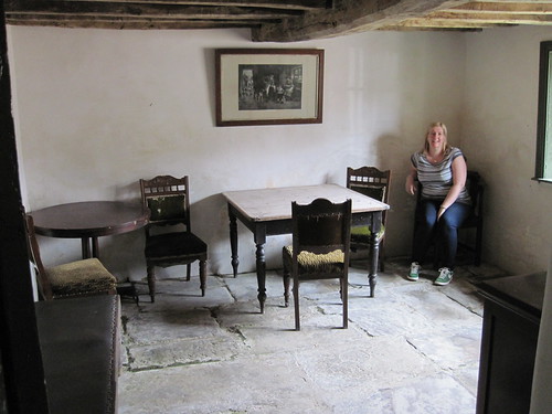
Spout House is a 16th century cruck framed farmhouse, named after a nearby spring.
Sun Inn, Spout House, Bilsdale
It became an ale house known as the Sun Inn in 1714
Sun Inn, Spout House, Bilsdale
The new pub opposite the house was built in 1914 and the original Sun Inn closed.Sun Inn, Spout House, Bilsdale
Remarkably the old house was then left undisturbed with its original furniture until 1979 when it was taken over and re-opened by the National Park Authority.
Sun Inn, Spout House, Bilsdale
An upper bedroom gives a view of the A-shaped cruck frame.
Sun Inn, Spout House, Bilsdale
Illustrations from ‘Englands Oldest Hunt’ published in 1907.
sh2
sh

Old Wives Well

Geotag Icon Show on map

Old Wives Well would once have stood on open moors, but it now hidden in the woods a short distance from the roadside. The name ‘Old Wife’ may imply a prehistoric origin to the site, a Roman Road also runs nearby.
Old Wives Well
The words “NATTIE FONTEIN” are carved into the well, and there are many suggestions as to its meaning, the most commonly quoted is a corruption of ‘Fons Natalis’ a celtic water nymph.
Old Wives Well
The site clearly still carries meaning for some as there ribbons in the trees all around, making this a Clootie well. Whatever your opinion the site certainly has a lot of history, even if its true origins are unclear.

See The Smell of Water for some more detailed research on the site.