Grosmont Ironworks

Geotag Icon Show on map

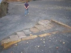
In what it now a car park are the remains of Grosmont Ironworks built in 1862 and demolished in 1892. Despite now being a rural setting the immediate area contains numerous ironstone mines.

Grosmont Ironworks

The most promenant feature is a large brick structure which is believed to be part of the system which carried raw materials to the top of the three blast furnaces. Apologies for the dark photos but it was getting late and I only had a basic camera.

Grosmont Ironworks Grosmont Ironworks

Grosmont Ironworks Grosmont Ironworks

Closer to the railway station is the base of the third blast furnace, added in 1876
Grosmont Ironworks

Alum House and Cementstone Kiln – Hummersea Steps

Geotag Icon Show on map

The footpath down Hummersea steps cuts right through the remains associated with the Alum House for the Loftus Alum Quarries.

Alum House, Hummersea Steps Alum House, Hummersea Steps Alum House, Hummersea Steps

The remains of the building are fast eroding out of the cliff and will likely be gone within a few years. The largest remaining stucture is thought to be a kiln for cementstone.

Alum House, Hummersea Steps Alum House, Hummersea Steps Alum House, Hummersea Steps

Nothing remains of the three story building with a large chimney which was photographed on the site around 1900, by 1910 it was a complete ruin with only a couple of small wall remnants left.

Loftus Alum Works

Geotag Icon Show on map

Loftus Alum works began operation in the 1650’s and ran until the 1860’s and cover roughly half a mile on a quarried shelf below the cliff. Alum is a mordant for fixing dyes to cloths.

Loftus Alum Quarry Loftus Alum Quarry

The quarrying process has left large sandstone cliffs at the back of the quarries

Loftus Alum Quarry Loftus Alum Quarry

The quarries themselves are still barren with little vegetation ever having returned to the slopes.

Loftus Alum Quarry Loftus Alum Quarry

Loftus Alum Quarry Loftus Alum Quarry

After quarrying the alum shale was burned for many months in large mounds called clamps, a process called calcining. Areas of burned red shale can be seen on the site, although its possible these are from natural fires at a later date rather than clamps.
Loftus Alum Quarry

There are the remains of several steeping pits, where the burnt alum shale would then have placed in water to dissolve the alum salts, these are rapidly nearing the cliff edge and will erode away in a few years time.
Loftus Alum Quarry Loftus Alum Quarry

Carved stone troughs can also be found which would have transported liquids around the site.

Loftus Alum Quarry

The alum liquor would have been transferred into a tank or cistern to allow any particles to settle out, a double walled circular cistern can be still be seen protruding from the edge of the cliff.

Loftus Alum Quarry

The settled liquor would then have been transferred to the Alum House where it was concentrated by evaporation until a specific concentration was reached, said to be the point where an egg would float in it. Akali (usually kelp or urine) was then added and the alum crystals formed as the liquid cooled.

Kettleness Jet Working and Shipwrecks

Geotag Icon Show on map

The whole area around Kettleness is heavily scarred by industry (despite now being very picturesque) there are workings for Jet, Alum, Ironstone and Cementstone all in a small area.

Ironstone was quarried on the foreshore and around the edge of the headland there are many inaccessible jet workings located high in the cliff.

Kettleness Jet Workings Kettleness Jet Workings

Down at sea level there are also numerous jet workings accessible at low tides


Kettleness Jet Workings Kettleness Jet Workings Kettleness Jet Workings

Traces of jet can still be found in the rocks in the area

Kettleness Jet

The headland has also taken victim much shipping over the years, with two wrecks identifyable.

Kettleness Shipwreck Kettleness Shipwreck

Kettleness Shipwreck Kettleness Shipwreck

One may be the Golden Sceptre which ran aground on 16/01/1912

Sundial, Albert Park, Middlebrough

Geotag Icon Show on map
The sun dial was donated by Henry Bolckow in 1879 (aong with the park itself in 1868)

Middlesbrough Sun Dial, Albert Park 

It was designed by John Smith of Stockton and gives the times in New York and Melbourne as well as Middlesbrough.

Middlesbrough Sun Dial, Albert Park Middlesbrough Sun Dial, Albert Park 

The plaque below it shows corrections for the time of year, accounting for BST its pretty much spot on for the time I took the photo.

 Middlesbrough Sun Dial, Albert Park

Henry Bolckow Statue, Exchange Square, Middlesbrough

Geotag Icon Show on map

Henry Bolckow  is acknowledged as one of the founding fathers of Middlesbrough, having been its first mayor. The statue by D.W.S.Stevenson dates from 1881 and was unveiled to a crowd of 65,000 by Lord Frederick Cavendish
Bolckow Statue, MiddlesbroughBolckow Statue, Middlesbrough

His statue stands with its back to the flyover that caused the demolition of the Royal Exchange, although it is now near its original position having been in Albert Park between 1924 and 1986

Around Exchange Square are some other remnants of the former Royal Exchange building.

Royal Exchange Carvings, Middlesbrough  Royal Exchange Carvings, Middlesbrough Royal Exchange Carvings, Middlesbrough