South Skelton Ironstone Mine

Geotag Icon Show on map

The most prominant building on site is the square compressor & haulage engine house.

 South Skelton Ironstone Mine South Skelton Ironstone Mine

The attached upcast winding house is situated adjacent to the capped shaft (216 feet deep – capped c.1985), a guide roller can still be seen in the slot through which the cables travelled. 

South Skelton Ironstone Mine South Skelton Ironstone Mine

South Skelton Ironstone Mine South Skelton Ironstone Mine

The wooden stable blocks and unique for the area, and its pretty amazing they havn’t been demolished or burnt down when you see the general state of the site and people who hang around there.

South Skelton Ironstone Mine South Skelton Ironstone Mine

South Skelton Ironstone Mine South Skelton Ironstone Mine

South Skelton Ironstone Mine South Skelton Ironstone Mine

Numerous other buildings can be seen around the site, which is remarkably complete.

South Skelton Ironstone Mine South Skelton Ironstone Mine

South Skelton Ironstone Mine South Skelton Ironstone Mine

(note the weather wasn’t wildly changable that day, the photos are taken about sixth months apart)

Grinkle Ironstone Mine, Culvert

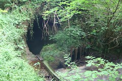
The culvert runs underneath the site of the Grinkle Ironstone mine.
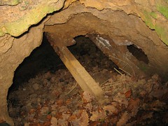
Internally the culvert is on the verge of total collapse, so I really wouldn’t recommend emulating my visit, a previous collapse in 1927 flooded the mine and trapped miners underground.
Grinkle Culvert Culvert

At the southern entrance of the culvert a large pool of water has backed up due to a collapse, here the tunnel seems to be cut into solid rock.
Culvert Culvert  

Upleatham Ironstone Mine, East Winning Hauling Engine

Geotag Icon Show on map

This second set of brickwork hauling engine bases mark the location of the East Winning drift, which was an open drift mouth until the early 1970s, nothing remains now other than a large depression in the hillside.

Upleatham Ironstone Mine East Winning Haulage Engine Upleatham Ironstone Mine East Winning Haulage Engine Upleatham Ironstone Mine East Winning Haulage Engine

Just to the east of this area, Quarry Lane is reached. Some remains of a bridge underneath the road are visible

In the woodland to the east of the lane there are many traces of ironstone quarrying and some concrete bases, possibly for an aerial ropeway that carried ironstone from Hob Hill mine to the east to be loaded into wagons at Upleatham.

Upleatham Ironstone Mine, Main Winning Hauling Engine

Geotag Icon Show on map

Situated at the top of Pontac Road, these brickwork Hauling Engine bases in the undergrowth are part of the scant remains of the second highest output mine in the area. The Drift itself was just a short distance to the south although no trace remains other than a depression in the ground.

 Upleatham Ironstone Mine Main Winning Haulage Engine Upleatham Ironstone Mine Main Winning Haulage Engine Upleatham Ironstone Mine Main Winning Haulage Engine

 A new gate has been erected in late 2008 which give some clue to the ironstone mining past.

Upleatham Ironstone Mine Commemorative Gate 


Ironstone Obelisks, Fabian Road, Eston

Geotag Icon Show on map

Outside the council offices on Fabian Road are two ironstone obelisks, reported to be 2.5 tonnes in weight.

 Ironstone Obelisks, Eston Ironstone Obelisks, Eston
The inscriptions say ‘Cleveland Ironstone Eston Mine’

Ironstone Obelisks, Eston 

A 2004 news report that says the pillars were moved to the site of the old hospital, so perhaps there are two more ?

UPDATE : As of the demolition of the council office in 2012 the obelisks have moved from this location.


Spa Wood Ironstone Mine

Geotag Icon Show on map

Ironstone was extracted from Spa Wood mine between March 1853 and December 1928.

Approaching from the east through large mine spoil heaps currently used by bikers, you first encounter a powder magazine

Spa Wood Ironstone Mine Spa Wood Ironstone Mine Spa Wood Ironstone Mine

Close by are the bricked up travelling and main drifts.

Spa Wood Ironstone Mine Spa Wood Ironstone Mine

In the next area to the west of the drifts are the offices and workshops which are still largely intact, having been part of a scrapyard until recent years. A chimney also stood here which was only recently demolished.

Spa Wood Ironstone Mine Spa Wood Ironstone Mine

Further west stand the remains of two fan houses for ventilating the mine workings. Finally to the extreme west of the site stands an electrical sub-station from the later years of electrication

Spa Wood Ironstone Mine

UPDATE : This location has since been purchased as a private residence and should no longer be visited.

Ayton Banks Ironstone Mine

Geotag Icon Show on map

Ayton Banks was mined by three different companies between 1909 and 1929, it was a small royalty entirely enclosed within Ayton Monument mine.
The most obvious remains are the numerous shale heaps, some with ironwork on top probably from aerial ropeways.

Ayton Banks Ironstone Mine

A number of building remains and foundation can be spotted in the dense undergrowth

Ayton Banks Ironstone Mine Ayton Banks Ironstone Mine  Ayton Banks Ironstone Mine

A very small length of drift is visible at the bottom of a large collapse, but its tricky to reach and also flooded.

Ayton Banks Ironstone Mine

About 100m to the south of the drift, iron stained water can be seen emerging from what was presumably a drainage level, this appears to be lined with corrugated iron sheets which have collapsed a few feet in, water can again be seen at the bottom of that collapse.

Ayton Banks Ironstone Mine  Ayton Banks Ironstone Mine

Victorian Urinal and bridge dedicated to Ironstone Miners

Geotag Icon Show on map

The bridge into Waterfall Park in Great Ayton is dedicated to five ironstone miners who lost their lives in the First World War.
Great Ayton Bridge
The under manager George Whitbread worked at Ayton Monument rather than Ayton Banks.

Over the bridge is a cast iron Victorian Urinal, it was originally one of three, it moved here in 1998 from Station Road.
Great Ayton Urinal